• Arroyo-Cam
  • Telemetry
  • Resources
  • Board
  • GIS Maps and Data
  • Home
  • Calendar
  • Ads And Notices
  • Projects
  • About AMAFCA
    • About AMAFCA
    • Programs
    • FAQS
    • AMAFCA Arroyo-Cam
    • AMAFCA Telemetry
    • Maintenance Activities
  • Contact Us
Skip to content
AMAFCA

AMAFCA Tumbleweed Snowman

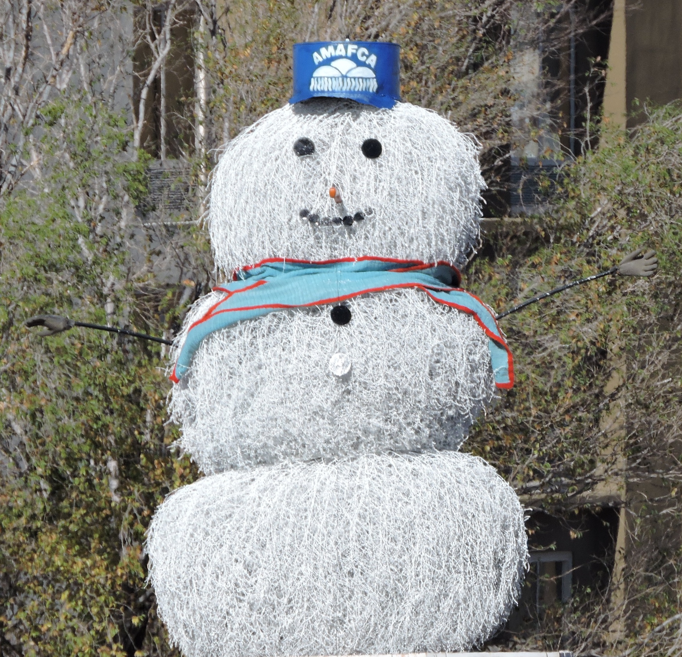
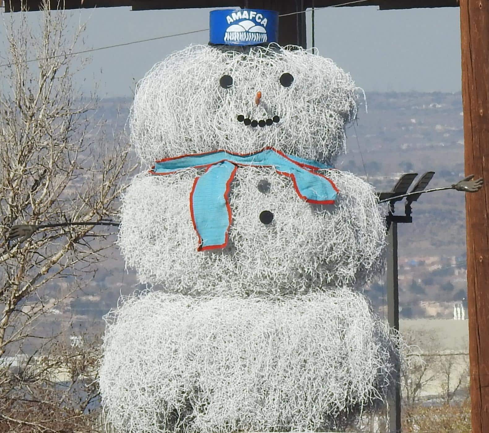
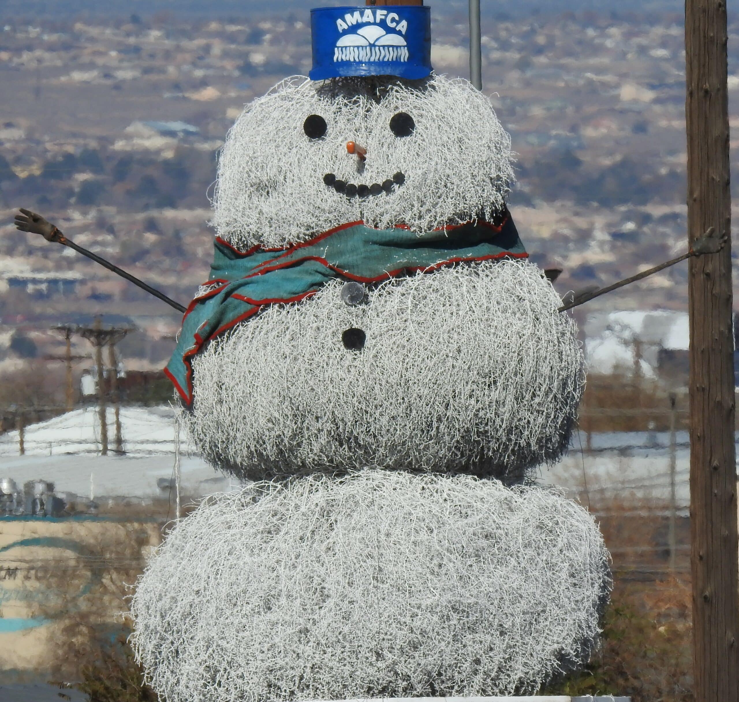
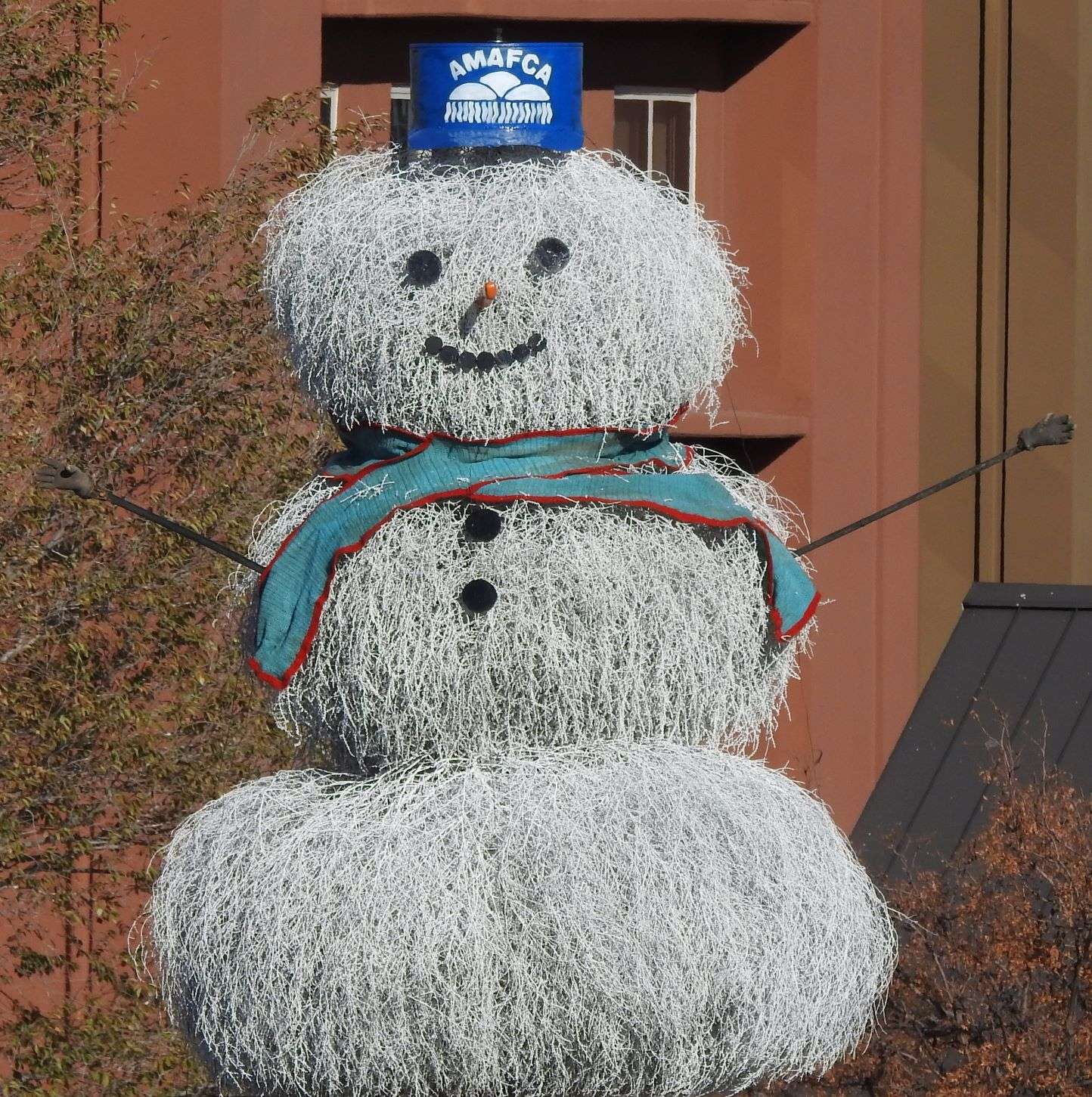
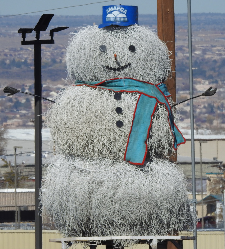
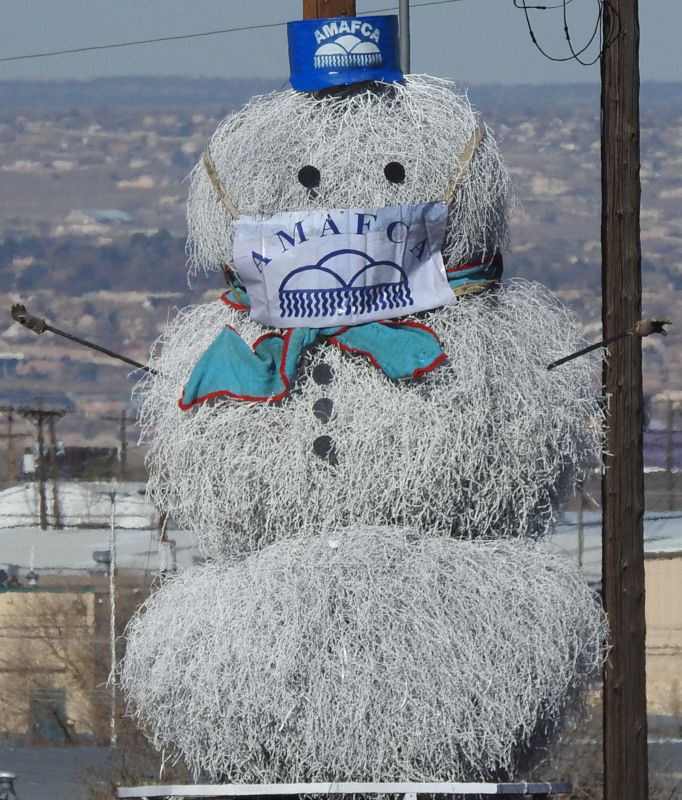
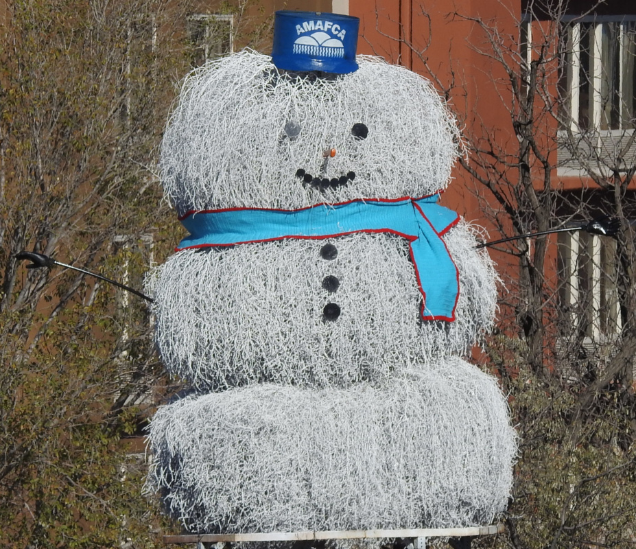
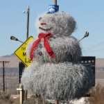
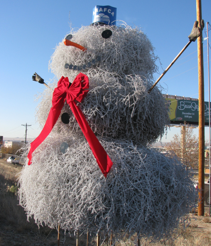
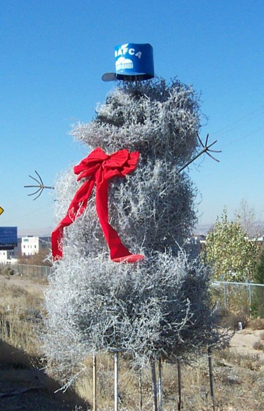
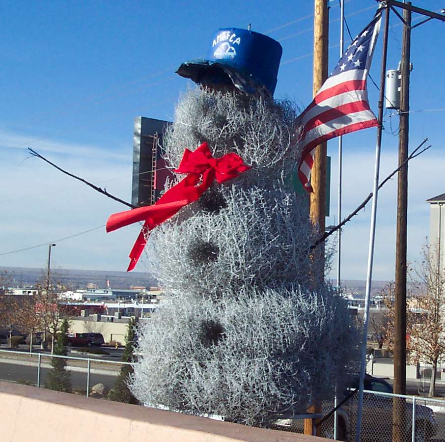
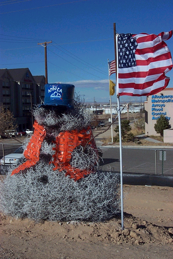
The AMAFCA Tumbleweed Snowman appears along Interstate 40 every year. His debut occurs on Tumbleweed Tuesday, the Tuesday after the Thanksgiving holiday. For most Albuquerque residents, his appearance signals the start of the holiday season. The tradition began in 1995 and the snowman has increased in size over the years. He currently averages about 12-14 feet tall, about 8 feet wide and is made up of only 3 tumbleweeds. His decorations are made of recycled materials. The eyes, mouth and buttons are made from scrap metal, his nose is a broken ax handle, his hands are old work gloves, and his hat is a 55-gallon drum. His scarf is knitted by the mother-in-law of one of our maintenance crew.


Albuquerque Flood Control

Ditch Safety

City of Albuquerque Storm Drainage Design

Keep the Rio Grand - The Storm Water Quality Team

Local Government

State of New Mexico

Bernalillo County

City of Albuquerque

Village of Los Ranchos de Albuquerque

Mid-Region Council of Governments

Middle Rio Grande Conservancy District (MRGCD)

Southern Sandoval County Arroyo Flood Control Authority (SSCAFCA)

Eastern Sandoval County Arroyo Flood Control Authority (ESCAFCA)

Geographic Information Systems

City of Albuquerque Interactive Maps (Advanced Map Viewer)

Bernalillo County Interactive Maps

AGIS - Albuquerque Geographical Information System

ESRI Homepage

Other Links

Real-time Surface Water Data for NM (USGS)

Statewide Real-Time Stream Flow Data for NM (USGS)

Rio Grande Gauge - water flow data (USGS)

North Diversion Channel - water flow data (USGS)

South Diversion Channel - water flow data (USGS)

Tijeras Arroyo - water flow data (USGS)

UNM Hydraulics Lab

UNM Hydraulics Lab Projects

National Pollutant Discharge Elimination System (NPDES) Manual

Federal Emergency Management Agency FEMA)

National Weather Service Albuquerque Radar (live image)

2021© AMAFCA | All Rights Reserved

Website by Toolbox Web Design

  • Home
  • AMAFCA Community Calendar
  • Board
  • Ads And Notices
  • Projects
  • GIS Maps and Data
  • Resources
  • News
  • About AMAFCA
    • Programs
    • FAQS
    • AMAFCA Arroyo-Cam
    • AMAFCA Telemetry
    • Back
  • Contact Us